Thailand Trip MapThailand Trip Map
MapGuidesTransporteSIM
Thailand Trip MapThailand Trip Map

Provinces of Thailand

Amnat CharoenAng ThongBangkokBueng KanBuri RamChachoengsaoChai NatChaiyaphumChanthaburiChiang MaiChiang RaiChon BuriChumphonKalasinKamphaeng PhetKanchanaburiKhon KaenKrabiLampangLamphunLoeiLop BuriMae Hong SonMaha SarakhamMukdahanNakhon NayokNakhon PathomNakhon PhanomNakhon RatchasimaNakhon SawanNakhon Si ThammaratNanNarathiwatNong Bua Lam PhuNong KhaiNonthaburiPathum ThaniPattaniPattayaPhangngaPhatthalungPhayaoPhetchabunPhetchaburiPhichitPhitsanulokPhra Nakhon Si AyutthayaPhraePhuketPrachin BuriPrachuap Khiri KhanRanongRatchaburiRayongRoi EtSa KaeoSakon NakhonSamut PrakanSamut SakhonSamut SongkhramSaraburiSatunSi Sa KetSing BuriSongkhlaSukhothaiSuphan BuriSurat ThaniSurinTakTrangTratUbon RatchathaniUdon ThaniUthai ThaniUttaraditYalaYasothon
© 2025-2026 thailandtripmap.com
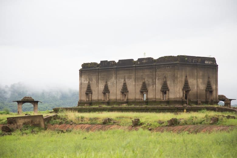
Wat Saam Prasob, the Sunken Temple cover image
A-

Attraction

Wat Saam Prasob, the Sunken Temple

Updated November 12, 2026

Wat Saam Prasob, also known as the Sunken Temple, is a unique structure that was submerged after the construction of the Vajiralongkorn Dam in 1984. During the rainy season, only its upper parts are visible, accessible by boat.

AddressKhao Laem National Park
Websitehttps://www.atlasobscura.com/places/wat-saam-prasob-sunken-temple →

Wat Saam Prasob, also known as the Sunken Temple or Wat Wang Wiwekaram, was once the heart of an old town inhabited by the Mon and Karen tribes. After the construction of the Vajiralongkorn Dam in 1984, most of the village was flooded, leaving the temple as the only remaining structure.